- Project: Farahzad Eco-Park
- Subject: Urban Regeneration of Farahzad River Valley in Punak District
- Design Team: Farzan Shamasblou, Alale Sarabadani.
- Rendering: Mohammad Akbari
- Project Type: Urban Regeneration/ Landscape Design
- Area: ~275000 m²
- Client: Urban Renewal Organization of Tehran
- Location: Tehran, Iran.
- Status: Competition Proposal (Honorable Mention)
- Design Year: 2019
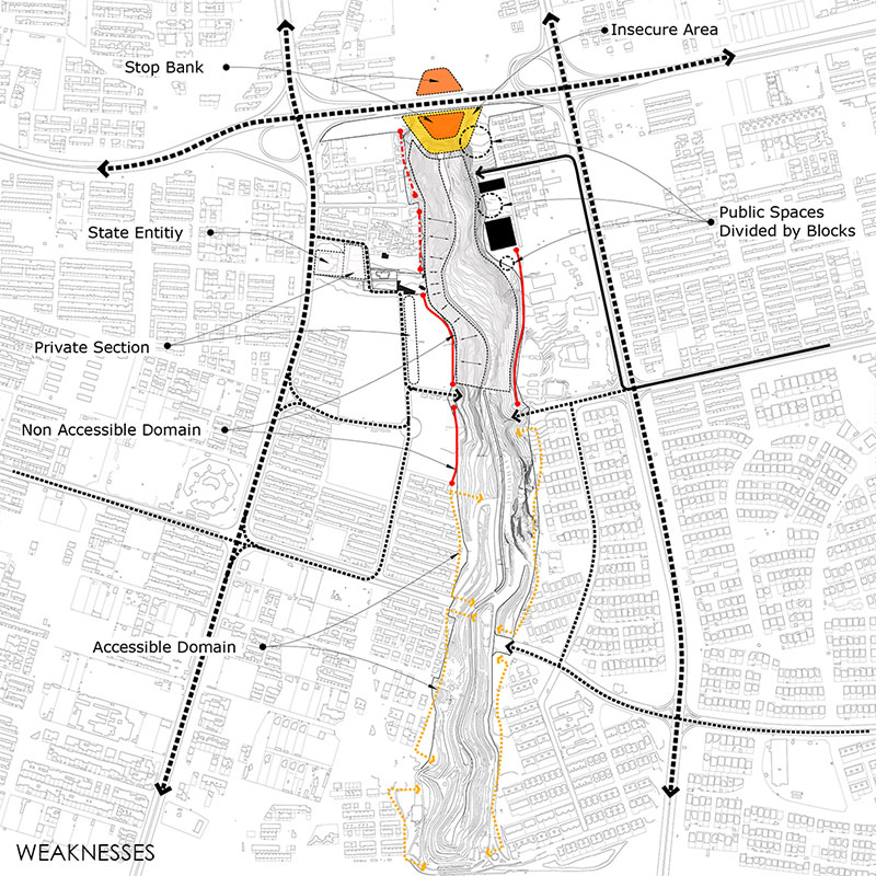
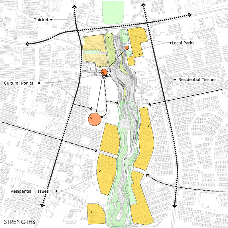
Drawings and Diagrams